Project FP 7 - INFORM
Improved monitoring and forecasting of
ecological status of European INland waters by combining Future earth
ObseRvation data and Models
CNR-IREA is a partner of the INFORM project,
and has the responsibility of the tasks regarding phytoplankton functional
types and macrophytes, as well as end-user interaction. We collaborate with the
CNR-IREA to integrate the limnological and ecological duties (site of interest:
Mantua Lakes). Also Klaipeda University is a partner of this Project.
INFORM aims to develop novel and improved user-driven products for inland water quality monitoring by using innovative methods integrated into biogeochemical models which fully exploit the capabilities of upcoming earth observation missions. Remote sensing is dramatically underutilized for the monitoring of inland waters mainly due to the complexity of these waters, the lack of adequate analysis methods allowing to deal with this complexity and the lack of adequate low-cost EO data for the often small or irregular shaped water bodies.
INFORM aims to develop novel and improved user-driven products for inland water quality monitoring by using innovative methods integrated into biogeochemical models which fully exploit the capabilities of upcoming earth observation missions. Remote sensing is dramatically underutilized for the monitoring of inland waters mainly due to the complexity of these waters, the lack of adequate analysis methods allowing to deal with this complexity and the lack of adequate low-cost EO data for the often small or irregular shaped water bodies.
|
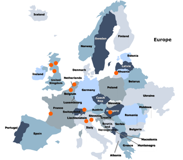
Monitoring of inland water quality based on
in-situ and EO measurements is fragmented. A European approach is needed to
optimally address the problems in these complex waters. To this end INFORM will bring together teams
from different member states and focus on a variety of inland water sites distributed
over Europe (See Figure).
|
|
INFORM aims to fill this gap by the development
of new analysis methods and products for several upcoming satellites (e.g.
Sentinel-2, Sentinel-3, EnMAP) which will provide a wealth of new data at
increased spatial, spectral and temporal resolutions.
Hyperspectral signatures will be exploited by new analysis methods to derive e.g. phytoplankton functional types and their percentage in the total biomass and discrimate between macrophyte species. To develop these products, a large suite of in-situ and airborne hyperspectral images of European inland waters is already available for INFORM. The APEX hyperspectral airborne sensor with new in-situ measurements will be used for simulation of the upcoming satellite missions, algorithm development and product validation. INFORM products will be used as input and for calibration of models which simulates the dynamics of nutrients, phytoplankton, including phytoplankton types and dissolved oxygen. End-user interaction will steer new data gathering and algorithm development to guarantee uptake of INFORM products by modelers, water managers and policy makers.
The main objective of the project is to explore and demonstrate how the new capabilities of upcoming sensors, combined with innovative analysis techniques and the coupling with biogeochemical models can be exploited to deliver new and improved products for inland water quality monitoring addressing better the end-user demands.
